The Earth Observation System (EOS) provides the infrastructure needed to study and document ecosystems in the St. Lawrence River Valley (VFSL) in Quebec in order to develop a quantitative predictive model of system-wide interactions in the geobiosphère-climate of the region. A key aspect of EOS is its ability to include a combination of fixed facilities and a flexible mobile infrastructure to observe and analyze the Dynamic Terrestrial System (DES) in remote areas of Quebec. The VFSL climate is characterized by exceptional weather conditions (eg, ice storms), varied uses of land (urban, natural, etc.) and biodiversity flows (species loss and invasion).

The station is located 10 km north of Sacré-Coeur, near the Ste-Marguerite River, a tributary of the Saguenay. The station is used for training in hydrometry, geomorphology, ecology and research in hydrology and fish habitats. The scientific equipment includes: a weather station, a water temperature monitoring station in the Ste-Marguerite River, an ADCP measuring the flow from May to November in the Ste-Marguerite River. Users also have access to mobile ADCPs (Sontek M9 and Teledyne Streampro), electric fishermen, thermographs and turbidimeters. The facilities include a laboratory area, a chalet with a classroom for 30 people, a dormitory for 35 people, a kitchen / cafeteria and a sanitary area with showers. She is in operation from May to November. The station belongs to the Interuniversity Center for Research on Atlantic Salmon (CIRSA) and is managed by the INRS.

Processing and analysis of earth observation images in order to map and model environmental phenomena in the context of climate change. The research team in Environmental and NORdic Remote Sensing (TENOR) works on the development and application of digital approaches and the development of analysis and decision support tools applicable to various contexts by calling upon particularly in hydro-informatics, geomatics and remote sensing. The Environmental Remote Sensing by Drones (TED) laboratory includes different types of drones and a wide range of sensors: two hyperspectral cameras (400-1700 nm), a thermal infrared camera, a multispectral camera with interchangeable filters and a digital camera. The TENOR team also has a computer laboratory equipped with software specialized in image processing and geomatics, as well as field instrumentation (georadar, snow and ice corers, hydrometeorological sensors, etc.) necessary for the development and validation of algorithms.

The purpose of the BEREV is to characterize the water cycle and the surface flows (energy, water and carbon) in a boreal environment in order to increase our understanding of the hydrological and hydrometeorological processes in the presence of abundant snow, in support of a better modeling and better forestry practices. In particular, BEREV has micrometeorological equipment above the canopy. To know more, watch this webinar about the BEREV: https://youtu.be/-bbwMuuYLYg
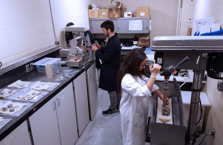
The research conducted at the Geothermal Open Laboratory is aimed at gaining better understanding of underground heat transfer and flow phenomena for reducing technical risks of geothermal energy. It is an open access laboratory, modeled after open-source software.
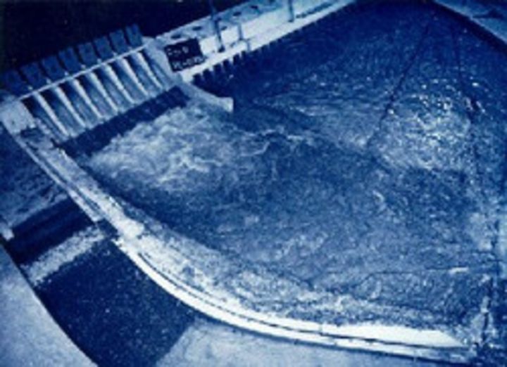
The UdeS hydraulic laboratory is one of the largest in Canada. It is used as much for the courses as for the research or the realization of expertises. Numerous assemblies and several channels allow the visualization and the experimentation of almost all the phenomena of the hydraulics with free surface and under pressure. It includes a 40 hp pump, a charging system, a gauging station, channels, numerous valves and a wave channel. Measuring instruments using the latest technologies, such as acoustic doppler velocimetry, are connected to computerized data acquisition systems.

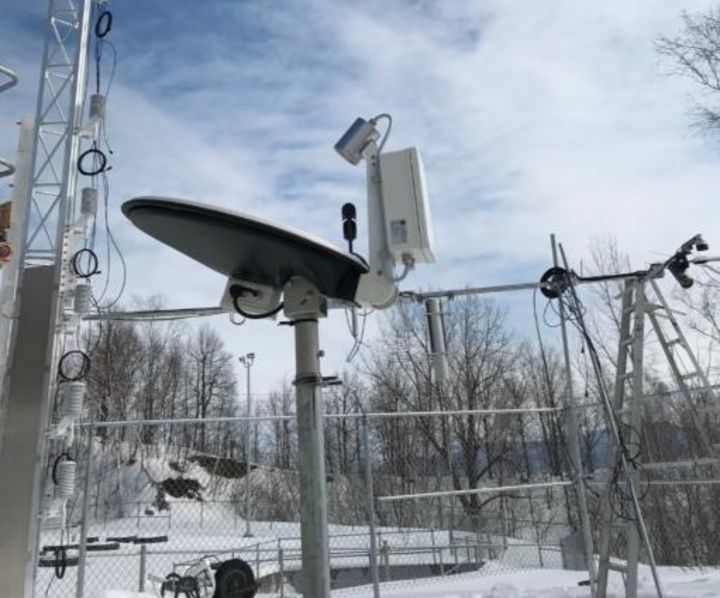
Le site NEIGE vise à contribuer à l’amélioration de l’estimation des apports en eau pendant la période hivernale grâce au perfectionnement des méthodes de mesure de la neige en milieu forestier, dans le biome boréal. Il permet d'évaluer la sous-captation horaire, bi-journalière et journalière des précipitations solides pour différents types de précipitomètres et de paravents installés à la Forêt Montmorency; de développer des équations utilisant des paramètres météorologiques usuels afin de permettre le débiaisage des données brutes de précipitation solide en fonction des appareils et des paravents utilisés; de comparer l’efficacité des appareils permettant l’estimation de l’équivalent en eau de la neige contenu dans le manteau nival; de favoriser le partage des données et des résultats entre les intervenants grâce à des activités de transfert de connaissance et des ateliers thématiques.